Thursday, December 10, 2015

THE REASON THE TREES ARE CUT DOWN

If you are a avid reader of Gassaway's Adventures, you may remember my post last August about the Juniper Trees being cut down in the Hart Mountain Antelope Reserve and I know you've been waiting for the answer as to, why?  For those one or two of you who didn't read the account at the time, this is what I wrote:

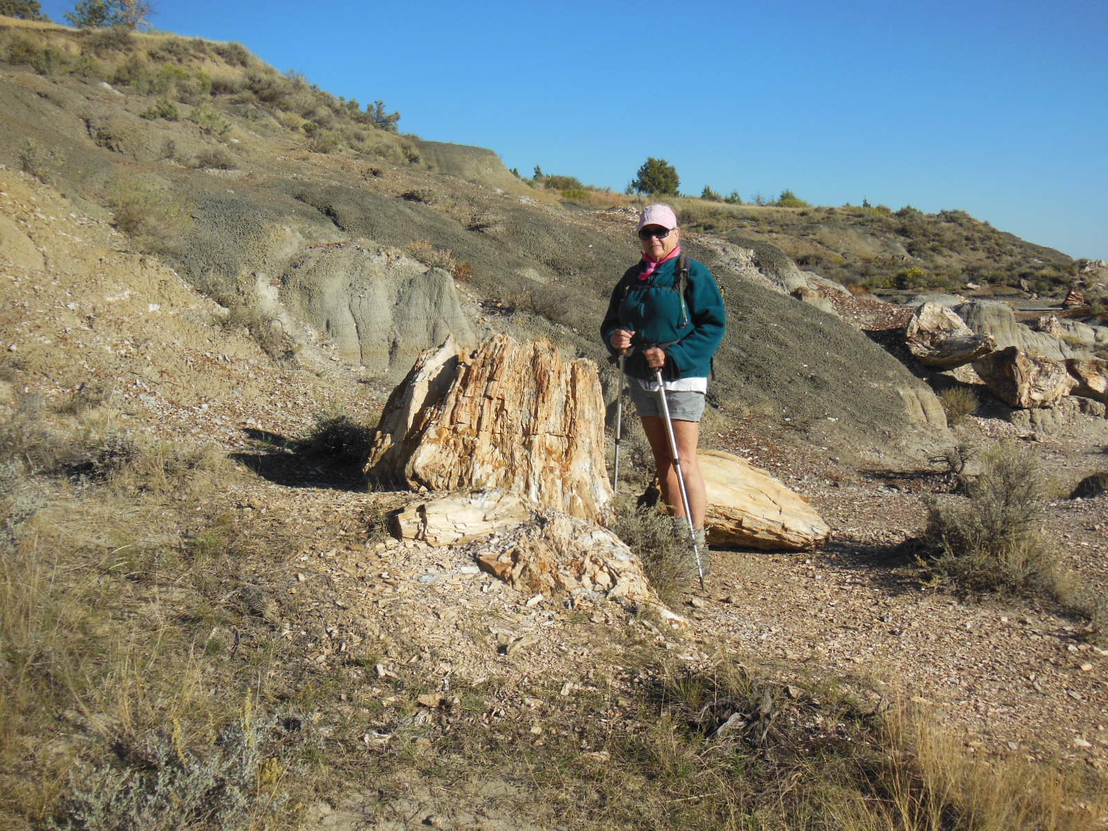
I noticed while on the refuge, that some of the Juniper trees were cut down.  Just left there laying on the ground.


Vandals, wood thieves or were they non-native trees or diseased?  So I asked a refuge volunteer who happened to drive into camp, what was up?  He told me that the trees are native, not sick and that they were being cut down to make it like it was 100 years ago in the refuge.  I said, "so you're helping nature".  He didn't like that comment.  I then suggested that if they wanted it to be like 100 years ago,  he should get out of the truck and walk.  I don't think he like that comment either.

It really pissed me off.  How do they know how many trees were there 100 years ago? If more trees have grown naturally, why are they messing with nature and cutting them down?  I'm going to get to the bottom of this and find out who the idiot is who made this decision.  When I find the answer, I'll post his name and address here so you can all tell him what you think. Stay tuned.........

 I sent the following e-mail and have yet to get a response:

On a visit to the refuge I noticed that Juniper trees were being cut down.  I spoke with a volunteer who told me that they were being cut down to make the refuge like it was 100 years ago.  Is this true?  Aren't the Junipers natural to the area?  If they are what possible good could it do to cut them down?  Who made the decision to cut them down?  Unless they are a non native plant overtaking native plants, I can't imagine that you could provide me with a reasonable answer.

I sent a follow up e-mail and again, no response.  I haven't given up, so next will be a phone call.  I'll keep you apprised of any news.

I made several phone calls, leaving messages that were not returned.  I finally spoke with the receptionist and asked her to forward my request to the powers to be.  Finally on October 20th I got an e-mail from Jeff Mackay, the Refuge Manager who provided me with his phone number telling me he would be happy to discuss my query.  So, I called and left several message.  Finally on December 8th, the elusive Jeff Mackay called me. His explanation is as follows:

Image result for sage grouse

First, the trees are not invasive nor are they taking over the refuge.  But, there are Sage Grouse on the preserve and they are close to being listed as an endangered species.  Sage Grouse range all over the west and if listed as an endangered species, many changes would have to be made to private use (grazing) on federal lands.  Why, are they close to being listed?  Well, Sage Grouse live in Sage Brush and that particular plant is in decline due to fires, grazing drought and other forces.  The Sage Brush on the reserve is pretty healthy and there is a good population of the aforementioned bird because of it.  What does all this have to do with the trees, you ask?  As luck or bad luck would have it, Raptors like to eat Sage Grouse.  It is one of their favorite meals and if you ask the Raptor, quite tasty.  You see, Raptors sit in Juniper Trees until they spy a Grouse and then they swoop down and catch the little buggers.  So, no tree, the Raptors have to go somewhere else to eat, like Grandma's chicken coop.  And that, my friends is why the Federal Government is cutting down the trees.  Only new growth trees mind you, not old 100 plus years old trees.  It's kinda like, killing one piece of nature so another part can survive.  We all know the the Feds know what their doing, so no worries.

Image result for raptor bird

Actually Mr. Mackay was very nice and we had quite a long conversation.  You can call him if you like at 541-947-2731.   Oh, I forgot to ask him, what about the Raptors, are they next?

Sunday, November 01, 2015

THIS ADVENTURE IS IN THE BOOKS

Well, we've been home a week now so figured it's time to put this our latest adventure to bed.  In the last post we were in Colorado and that's where this post begins.  In Colorado and most places in the northern half of the county, the U.S. Forest starts closing their campgrounds in September and by the middle of October you are pressed to find one still open.  Outside of Woodland Park we managed to find just one still open if only for another week.  Besides the camp host and us, there was just one other camper in the campground, so we had our choice of spots.  That being said we had difficulty finding a site our rig would fit into.


After just two nights in Woodland Park we continued our journey west to Buena Vista in the middle of the Rocky Mountains.  As we explored the area we found some great fall colors.


We also happened upon one of the area's natives.


We managed to get in a couple of nice hikes in the area, the first being to Lost Lake. Located at just shy of 12,000 feet, hike was made possible because we started walking at just shy of 12,000 feet.  With no elevation gain to speak of, we managed just fine, but we did feel every bit of that 12,000 feet.  Under clear but crisp skies we topped a rise in the terrain and came upon the small lake situated just below the Continental Divide in a beautiful setting.  The lake has a small island and is surrounded by the lake's dark green color.  Since we found the lake, it's no longer lost.


The water was just a tad too cold for swimming as ice was forming around the edges.  In a matter of days or perhaps a week, the lake will be frozen over for the winter.


Our next hike was a little easie,r although still high at 11,000 feet, it followed an abandoned rail road, thus keeping the grade at a manageable angle.  We've hiked this route before but it's beauty demanded a second look.  All the rails have long since been removed, but some of the wooden ties are still there.  The Railroad was in operation from the late 1800's into the early 1900's but abandoned when a tunnel under the Continental Divide collapsed.


On the way back to camp, we stopped and paid a visit to St. Elmo, a still partially occupied gold town.


The following day was opening day of hunting season putting an end to our hiking in Colorado so we headed southwest to Moab, Utah.  Most followers of our blog know that Moab is one of our favorite places as it get mentioned here often.  We lucked out and got a campsite at Goose Island, a BLM camp on the banks of the Colorado.


We managed to get in a couple of hikes, but we were dodging thunderstorms, which in these parts can be quite dangerous.  We took a great hike to Neck Spring in Islands in the Sky district of Canyonlands National Park.  We lucked out as the rain started just as we were returning to the trailhead.


THE RAIN APPROACHES


Line at the bathroom so we opted for a bush, there was no waiting

As we were heading back to camp the skies opened up with a downpour that lasted about 45 minutes.  Glad we weren't caught out in it.  Something to see with the water cascading off the red cliffs.


I did manage to get one short bike ride in on the new bike path that goes from town and along the river.


Well, that does if for this adventure. There of course will be more.  In our next adventure we will be walking the Camino de Santiago in Spain, so you can follow along on our Camino blog, Walking Our Camino.


Thursday, October 15, 2015

HERE'S AN UPDATE

Not much to report which is good because I've been suffering with writers block. We left the Dakotas behind and continued south into Nebraska and a stop near Omaha in the town of Papillion.  They have a really nice city park and campground, where we have stayed several times before.  Great bike paths in the area which I took advantage of.  Also there is a Trader Joe's in Omaha, our first since Boise, as I was running low of Two Buck Chuck.


After a couple of days we continued south into Kansas sticking to the secondary roads avoiding the interstate where possible.  We have never really explored Kansas before and things looked ok in the eastern part of the state, but the western half was mainly devoid of anything to look at.  The highlight of our Kansas excursion was the Eisenhower Presidential Library in Abilene.  On the site is Eisenhower's boyhood home, a museum, library and a chapel where he and Mamie are buried.  We took the tour of the home which is located on the original site and all of it's contents are original.  Eisenhower had 5 brothers and they shared two bedrooms in the small home.


Most of the Museum covered Eisenhower's involvement in WWII and only about 25% of it to his presidency.  Still a very interesting visit.


We continued west across western Kansas as fast as we could, killing a large population of grasshoppers, butterfly's, and misc bugs along the way.  We stopped for a couple of days at a forest service camp just outside of Colorado Springs.  We did a little exploring and then took the drive to the top of Pikes Peak.  After paying the toll, we drove to the top on a sometimes scary road.  Actually the road it's self is really nice, it's the drop-offs on the edge of the road that make you pucker.  At 14,115 feet in elevation, it was our first "fourteener", even if we did opt to drive rather than hike.


We also made a stop at the Garden of the Gods, a Colorado Springs City park which is quite spectacular. 


Well, that's it for this post.  We continue west into the Rocky's and Utah before ending this adventure.


Wednesday, October 07, 2015

MORE OF THE DAKOTAS AND PILGRIMS


We really enjoyed Theodore Roosevelt Park but it was time to move on, so we continued east stopping first in Bismarck.  The city park we stayed in was nice, but the city was pretty drab.  After two nights we decided that perhaps Fargo would be more exciting, so we cut our stay short and moved on down the road.  Upon arriving in Fargo, a friend sent me a message in which he asked "Did ya ever stop to look around Fargo and ask yourself....why the hell did they stop here?"  My response was, "They had already been to Bismarck."

Actually Fargo was a nice city, with a city park along the Red River for camping and bike riding.  Also in the visitor center you can find the wood chipper used in the movie Fargo.


While on my bike ride, I crossed the river into Moorhead, Minnesota and came across this church.  It is a full scale replica of a Norwegian Stave Church.  These churches were built just after the close of the Viking Age in Scandinavia around the 1100 and 1200's.  The technique of using vertical posts or staves had been modified over time to become wooden architectural works of art.


We also paid a visit to the Fargo Air Museum where, besides the air planes, Cathie picked out a pair of boxers from the gift shop.


One of you asked, "Why North Dakota?"  Well, it's close to Winnipeg, Canada and Winnipeg is home to Len, who I met and walked with on the Camino de Santiago in Spain.  Actually I wanted to go to North Dakota, but decided early on to stop for a visit with Len.  Len and his wife Janet couldn't have been better hosts.  We camped in their driveway, also known as mooch-docking, they fed us, and showed us the sights.  Of course any visit with a fellow pilgrim has to involve a hike or two.  We had a great weekend with Len and Janet and they have promised to pay us a visit in San Diego.


Turns out the Manitoba and the area around Winnipeg has something in common with North Dakota.  It's flat, really, really, flat.


So, after leaving Canada I received a message from Howard, who along with his wife Joy walked the Camino de Santiago with me.  Turns out they were heading east across South Dakota as we were heading south.  Our paths crossed just outside of Sioux Falls at Palisades State Park and we spent a great afternoon and evening together.  This is how it is with pilgrims.  They become part of your Camino Family and given the chance will get together to talk about the Camino.  In fact Howard and Joy were heading into Minnesota to visit with more pilgrims.


We are now in Omaha at Walnut Creek Recreation Area, a campground we've been in before.  There's a Costco and a Trader Joe's, so we shall resupply before heading south into Kansas.  We are on the downside of the trip and should be home by the end of the month.


Saturday, September 26, 2015

THE DAKOTAS


We spent our last morning at Devils Tower taking a 5 mile hike around the tower. Beautiful early in the morning.  We then pulled up stakes and continued east into South Dakota and the Black Hills.  Of course any trip to the Black Hill wouldn't be complete without stopping to pay a visit to the presidents at Mt. Rushmore.  We had been there once before in the 80's and at the time the new visitors center was under construction.  Now completed, it really looks great.  No entrance fee, but it did cost $11 to park.  There's been talk of putting Obama to the left of President Lincoln.  What do you think?


The Confederate Flag has not been banned at Mt. Rushmore


As a bike rider I'm always looking for designated bike trails to explore.  For me, I like level and I'm not into mountain biking, so you can say I like easy.  The George Mickelson Trail is one such trail.  Running from Edgemont to Deadwood, a distance of 110 miles, the trail follows the abandoned Burlington Northern rail line.  With grades no more that 4%, it is my kind of bike ride.
No, I didn't do in entire 110 miles, but did go for about 20 miles.  I'll have to return to finish it one day.


We headed north from the Black Hills into North Dakota for a visit to Theodore Roosevelt National Park.  In the Bad Lands of Western North Dakota, the park is divided into the south and north units, which are about 50 miles apart.  Both sections of the park are bisected by the Little Missouri River, which takes on the brown color of the bad lands.  From the park service web site:

When Theodore Roosevelt came to Dakota Territory to hunt bison in 1883, he was a skinny, young, spectacled dude from New York. He could not have imagined how his adventure in this remote and unfamiliar place would forever alter the course of the nation. The rugged landscape and strenuous life that TR experienced here would help shape a conservation policy that we still benefit from today.

With bison and wild horses roaming the landscape it is almost like going back it time.  We took a look in a cabin that TR lived in for a while and also drove the back roads to the site of his ranch on the banks of the Little Missouri.


We did see bison from time to time, one here a couple over there, but one evening we took a drive on the the park loop.  Bison were everywhere, especially after it got dark and usually in the middle of the road.  I guess we must have seen over 100 of them.


We wanted this campsite, but it was taken


We caught Teddy outside of his cabin.

We did manage to get in a hike or two.  One was to the petrified forest, where there are lots of tree stumps.


 Road to Teddy's Ranch


Oil wells are everywhere in this part of the state.  The oil boom is in full swing, so if you want a job, this is the place to get one.

UPDATE

About the trees being cut down in the Hart Mountain Antelope Reserve.  I sent the following e-mail and have yet to get a response:

On a visit to the refuge I noticed that Juniper trees were being cut down.  I spoke with a volunteer who told me that they were being cut down to make the refuge like it was 100 years ago.  Is this true?  Aren't the Junipers natural to the area?  If they are what possible good could it do to cut them down?  Who made the decision to cut them down?  Unless they are a non native plant overtaking native plants, I can't imagine that you could provide me with a reasonable answer.

I sent a follow up e-mail and again, no response.  I haven't given up, so next will be a phone call.  I'll keep you apprised of any news.