We've traveled to and through Arizona many times, mostly through, on the way to other parts of the US. Only scratching the surface in previous visits it is now our duty as residents, to begin to see the many wonders of this beautiful state. In that endeavor, we decided to check out three different off road routes in Central and Southern Arizona. Not the rock-crawling, try to make it off road trail, but more sedate roads in the National Forests of Arizona. So we spent three nights and four days with our off road trailer camping out in the boondocks with no one around. Beautiful weather with clear skies, making for starry nights and only the sound of the coyotes and owls to keep us company at night. I should mention that in the southern part of the state on the Mexican Border, we did hear the US Border Patrol passing by throughout the night.

First up on this adventure, just north of Tucson, we explored the Ironwood Forest National Monument. After turning off I-10 at Red Rock, we were soon on good dirt roads. The Silverbell Copper Mine has been in operation for years and is still producing copper to this day. Our first stop was at the Sasco Cemetery to pay our respects to past residents who worked and lived here. The cemetery is still accepting new internees, mostly local residents. We had hoped to stay at the Silverbell Rockland Hotel, but as was no longer accepting guests, so we opted for a side road in the Saguaro Cactus to set up camp. Nice quiet location, but we were discovered by the local sheriff who was out and about seeing what was up. He told us that many illegal aliens pass through and want to make sure I was armed. That's Arizona for you. Never did see and Illegals.


Speaking of murder, in April of 1919 Charly Coleman's wife was living in Sasco and apparently was being hit on by other men. Charley, who lived in Tombstone at the time, got wind of this and decided to head to Sasco to settle the score and kill the two men hitting on his wife. Upon arrival to Sasco, Charley got into an argument with his wife. (Go figure) The owner of the saloon who had already heard about Charley's intention to kill the two men, heard the argument in process and fetched his 30-30 rifle and shot Charley on the spot.
We had a peaceful night sitting around the campfire watching the stars come out. With the local Sheriff in the neighborhood and Charley out of the picture we slept well and comfortably in our roof top tent. The next morning we continued our loop through the Ironwood Forest and after "airing up", we headed south to the small town of Patagonia.

Located just north of the Mexican Border, Patagonia is near the southern terminus of the
Arizona Scenic Trail. It traverses Arizona from south to north or the other way around if you like walking south. Anyway, lots of pilgrim looking folks carrying large backpacks. We opted to stay in the 4X4 as we weren't equipped for a 800 mile walk across the state. Anyhow, just south of town is the 50 mile Ghost Town Loop, which we intended on exploring. Now, most of the ghost towns in these here parts only consist of a buildings or two, so mostly we were here for the scenery. First up is the Patagonia Mountains which separates the town from Mexico. As it was getting late, our first priority was to find a campsite. Most of the roads in the area are well maintained dirt roads. Because of the close proximity to Mexico, they are well traveled by the Border Patrol. We felt completely safe as most of the illegal aliens are harmless and tend to travel away from the BP and roads. As the previous night we never did see any illegals. Anyway we found a secluded campsite just off the road. At about 7,000 feet it got a tad chilly that night.
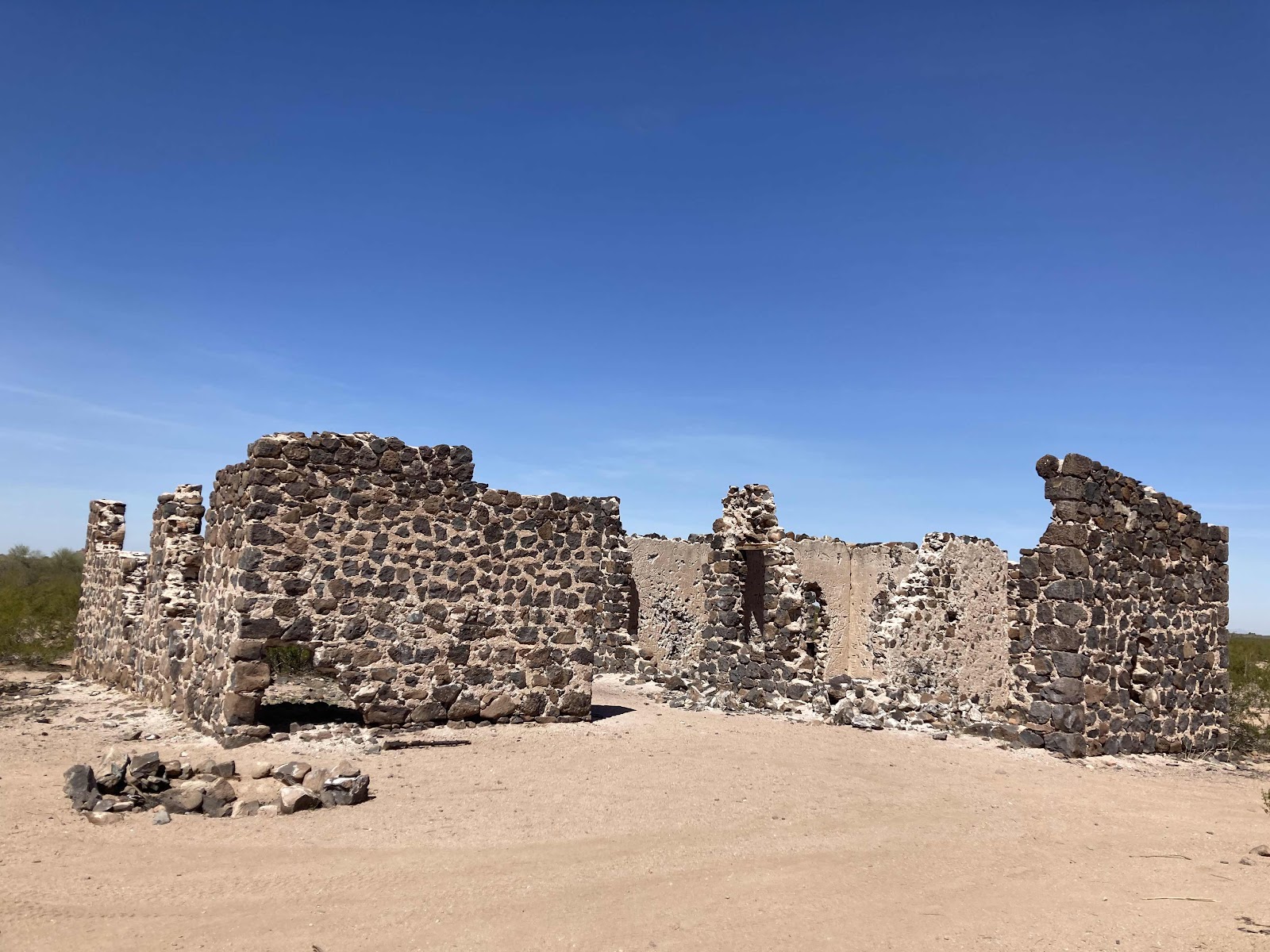
The next morning after breakfast we continued south stopping on occasion for a photo of another "ghost town".
HERSHAW
DUQUESNE SCHOOL HOUSE
LOCHIEL SCHOOL HOUSE (restored)
Some people still live in Lochiel, but the school house is now a museum. Situated at the south end of San Rafael Valley it is a stones throw from Mexico. The plaque on this monument reads:
By This Valley of San Rafael
Fray Marcos de Niza
Vice-commissary of the Franciscan Order
and
Delegate of the Viceroy in Mexico
Entered Arizona
The First European West of the Rockies
April 12, 1539
Here we turn east and then north, passing through the San Rafael Valley and it's vast grasslands. Beautiful gently rolling land that reminded me of the Mesita in Spain.
Miles and miles of open range with a few cattle ranches. I would love to see this area during the Monsoon when the grass is green. Guess we'll have to go back. But now we head north to our last area of exploration.
North of Phoenix off of Interstate 17 is an off ramp to Bloody Basin Road. Since our home in Prescott is nearby, we have passed this off ramp numerous times. Now was the time to check it out. It was late afternoon when we made our exit from the freeway and entered the
Auga-Fria National Monument. So, first up was to find a campsite. About 5 miles down the nice graded dirt Bloody Basin Road, we found a perfect spot beneath a large Sycamore Tree. The evening was spent around the campfire, being serenaded by a couple of owls, then off to bed.
The next morning we're up early and out of camp at a decent, for us, 8:30. The road goes for about 38 miles to the Verde River and
Sheep Bridge, where for all intensive purposes the road ends. I did some research on this road and it is described as an easy 4-wheel drive road. As we leave camp, the road is a nice pretty well maintained forest service road for the first 28 miles. A few stream crossing and over a high pass, but a nice scenic road none the less. The last 10 miles or so is rocks. Lots and lots of rocks. Still doable with out a 4X4 as long as you have a high clearance vehicle. But it's slooow going. Seldom more than 5 MPH. The main issue with me was that we had to turn around and drive over all those rocks to get out of there. Would I do it again? You would have to give me a really good reason to spend another 6 hours driving over those rocks. The rocks, I might add, we placed in such a position that you had to drive over everyone of them.

SHEEP BRIDGE AND THE VERDE RIVER BELOW
NOT MY PHOTO, BUT YOU GET THE IDEA
We made it out ok, and headed home for a dinner out and a well deserved shower. We saw new places for us and I discovered that 3 nights in the tent is my limit. Cathie could go 4, but she's tougher than me. We'll be going again as there are so many remote places to explore in our new state, Arizona.


