Friday, November 20, 2009

TILTING AT WINDMILLS

For the past eight years or so, I’ve wanted a windmill for my yard. Not one of those lawn art type imitation windmills, but a real full sized one. Why, you ask? Because I think they look neat and I want to watch it turning from my front window. Over the years I have looked for one on our travels in the southwest. We see lots of them standing abandoned on vast rangeland and next to old farm houses throughout the west, some still in use, but many standing derelict and in a gradual state of decline. When on the rare occasion, I’ve checked online to find one for sale, the price has been out of reach for me, as I am always looking for a deal. But I’ve always continued looking and on occasion photographing them.


After returning home from our last trip, on which I saw numerous windmills, I got a call from my neighbor Willie. Willie told me about a windmill in Sunnyside, just three miles from our house that was for sale. The asking price was something I was willing to pay and far less expensive than anything I have seen before. I went and took a look and discovered that it was down on the ground, saving a lot of headache getting it down. It also appeared that all the parts were there. According to the owner, he had bought it in West Texas in 1969 with the intention of putting it on his well. He never did, so it just sat in his yard for the last 40 years. The 30 foot tower seemed to be in pretty good shape, but the engine, the part the wind vanes attached to, needed work. After several days of consideration and in serious consultation with my engineer friend Duane, I decided it was a project I could tackle. I made the owner an offer he couldn’t refuse, shaving several hundred dollars of the asking price. The owner, who had been tipping a few at the time of our negotiation, made a counter offer and we had a deal. I was now the owner of a real life Aerometer model 702 30 foot windmill. Now I had to get it home.

Luckily, Willie happens to own a construction company, has a 30 food flatbed trailer in his inventory of equipment. So with sons, Gray, Eric, friend Duane and Willie and his trailer, we managed to load the tower on the trailer for the trip to its new home.

The windmill is now in my back yard, and Duane and I have begun the process of overhauling the windmill engine. It is nearly completely dismantled, with the exception of the final gears, which are rusted in place. With a little luck and a gallon of WD-40, in due time we’ll manage to break though the rust and begin the reassembly portion of this, my new project.

I don’t know how long it will take to get everything ready, but there will be a windmill raisin party when we raise the windmill at its new home in our front yard.


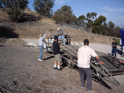
GETTING READY TO LOAD IT

IT'S ON THE TRAILER

OFF LOADING

THE ENGINE


Saturday, November 07, 2009

HEADING HOME

We stayed three days in Silver City and one of those days we drove north about 60 miles to Glenwood, New Mexico and the Catwalk National Scenic Trail. The Catwalk follows the path of the pipeline built in the 1890s to deliver water to the mining town of Graham. Workmen who had to enter the canyon by crawling atop the narrow pipeline named the route the "Catwalk." In the 1930s the Civilian Conservation Corps rebuilt the Catwalk as a recreation area for the Gila National Forest. The Forest Service built the metal walkway in the 1960s. Parts of the trail have been rebuilt several times since then due to the flooding of Whitewater Creek. The path leads to the unique feature of Catwalk. Metal walkways are bolted to the narrow canyon walls where there was no room to cut a trail. One expanse of the walkway is on girders stretched across the canyon. Between the creaking metal grates of the Catwalk you can see the swiftly running water below. In other parts the walkway hugs the canyon wall. The rock, worn smooth by years of erosion, arches over the pathway


There are times when writing this blog I make mention of great campgrounds we’ve discovered. I can’t recall a time that I’ve mentioned a private RV park as usually they are not very scenic or worth pointing out. In Silver City we found one that is. Manzano’s RV Park is owned by a semi-retired couple who take great pride in their small RV park. Sites are not close together and each is divided by the natural landscape. It's off the highway and very peacful. If you’re ever in the area, it’s a great place to stay.


MANZANO'S

We are now nearing the end of our trip, with the last couple of days spent in Bisbee, Arizona, an old copper mining town situated in a narrow canyon above a large abandoned open pit copper mine. Today the town survives because of the tourists who stop here.


BISBEE


BISBEE OPEN PIT MINE

Tomorrow we hook up the trailer for the last time and head for home. Once again we’ve had a great trip. The first six weeks of the trip was spent with Gray and Diane, their longest trip to date. We revisited some places and discovered new ones, but since we’ve run out of money, not to mention "Two Buck Chuck", it’s time to head for home.
Here's a link to Gary and Diane's Blog"


Tuesday, November 03, 2009

SNOWBIRDS

IT'S NOT MUCH, BUT IT'S COLD!


Well it was snowing in Albuquerque so we figured we should follow the snowbirds and head south. We had a great visit with our hosts Terry and Sharon and we will return the favor when they park their RV in our yard in December.

From Albuquerque we stopped for three days at Oliver Lee State Park just south of Alamogordo, a really nice campground at the base of the Sacramento Mountains. While in the area, we spent some time at White Sands, walking and bike riding. With great weather with temperatures in the 70’s we are staying south with the next stop in Hatch, NM, the Chili Capitol of the World. Real chili lovers buy fresh or fire roasted chilies in 20 pound burlap bags, but we stuck to a couple of Chili Ristras and of course some hot green chili salsa.

Today we arrived in Sliver City, NM and plan on staying for the next couple of days. The city is an old mining town with lots of history and lots of place to explore in the area.

Here’s a couple of links if you’re interested.

http://en.wikipedia.org/wiki/Oliver_Lee_Memorial_State_Park

http://www.hatchchilefest.com/


Also some recent photos:

NEW MEXICO SUNSET


NEW MEXICO MOONRISE

WHITE SANDS RESIDENT

WHO NEEDS AN ATV


HATCH, NEW MEXICO


Monday, October 26, 2009

NEW MEXICO

TAOS SUNRISE

THE TAOS PUEBLO

After bidding goodbye to Gary and Diane, we headed southeast towards Taos, New Mexico. With one detour due to snow over a 10,000 pass, we arrived and settled into an RV park just outside of town. We spent 3 days in Taos, visiting the Taos Pueblo and the Kit Carson Museum. As a collector of pueblo pottery, the Taos Pueblo is a great place to buy directly from the artist who made the piece. After helping out with the local economy and with the threat of snow we continued our journey south.

Our RV is currently parked in the yard of friends Terry and Sharon in Rio Rancho, just outside of Albuquerque. So far the weather has been sunny but cool. The forecast is calling for rain and snow in a couple of days, so we just might stay put until it passes.
Today we drove to the Jemez Mountains just north of here. Terry and Sharon like to hike as we do, so we took what was to be a 4 mile trek along the Jemez River. With a light dusting of fresh snow, it was a really beautiful and peaceful. Terry had heard of a “water cave”(whatever that is) a bit further down the trail and the 4 miles ended up being 10. We never did quite make it to the water cave as the trail became very steep and icy. None the less we had a great hike in the snow.


CATHIE, SHARON, TERRY AND LADY

SNOW SCENE

JEMEZ RIVER FALL COLORS


Wednesday, October 21, 2009

NEW FRIENDS

If you have ever traveled in the southwest and stayed in campgrounds and RV parks you notice right away a large number of folks driving rented motorhomes. In my own unscientific survey, I determined that most of the people driving these RV’s are European with Germans making up the majority. While camping in Bluff, I noticed a European style motorhome with German plates in a nearby campsite. In an effort to promote friendship between our two peoples, and to find out about their motorhome, I invited the occupants to join us around the campfire.

Hans, was traveling around the southwest with his 21 year old son, Frank and a rather large and intimidating looking Sheppard. Hans told us he shipped his motorhome to the states via container ship from Germany to Baltimore and has been traveling around the west for close to 5 months. He said he had to return to Germany on the 1st of November but intended to store his RV in Los Angeles. Then in the spring he would return for 5 more weeks of US travel ending in Baltimore to ship his RV back home.

In two nights of campfire talk, we learned that Hans was in the same business as Gary and I and worked in a small town in the Black Forest. He had saved up his leave time for his trip to the states. Hans gave us a tour of his very compact but well designed and built Mercedes RV knowing full well, that someday we will have to downsize for economy sake. He gets 20 MPG compared to our 10. Gary offered to find a place to store his RV when he returned to Germany and Hans took him up on the offer. With Cathie and I going to Europe in the spring, Hans invited us to come and visit him in the Black Forest, which, if he’s not in the U.S. at the time, his invitation will be accepted.

After six weeks, Gary and Diane have decided to head for home, this being the longest they have ever been away. The previous record for them was 2 weeks. We parted company in Cortez, Colorado with Cathie and I heading to New Mexico. The weather is turning cold, with snow in the nearby mountains, so it’s time to head south.
WHAT A CREW!


OBTAINING LANDSCAPING MATERIALS


Sunday, October 18, 2009

BEAUTIFUL STUFF---SCARY STUFF

CAMP ON THE SAN JUAN

We found a really nice BLM campground in Bluff, right on the San Juan River. We have been having great clear weather with cold nights but warm days in the high 70’s. The trees in the campground are all turning gold making this the prettiest place we’ve stayed so far.

As I mentioned in the last entry, we’ve come here to explore some cliff dwellings which after hiking to, you can explore on your own. No rangers or guided tours. Our first exploration took us to a place called Mule Canyon, where after hiking about 1.5 miles we came to our first ruin. With easy access we scrambled up the slickrock to a small cliff dwelling located under the cliff overhang. The popular name for this ruin is, “House on Fire”, and if you look at the photo below you can see why. There were several small individual “rooms” at this site possibly used as granaries.

HOUSE ON FIRE

We next continued up canyon to another small ruin. At this point the ladies decided to head back to the truck because, “once you’ve seen one ruin, you’ve seen them all”. Gary and I continued on finding one more ruin high on the cliff. We could climb to a spot about 15 feet below it, but we couldn’t scale the vertical wall to make entry.

CAN'T QUITE REACH IT

I had read about a ruin called “Moonhouse Ruin” located in the area, so the following day, Gary and I headed out to see if we could find it. I had some detailed directions found on the internet and in a book I purchased but I had some doubts if I could make it. You see, I am very afraid of heights, especially those which involve me walking on narrow ledges over deep canyons. (Well actually anything over about 8 feet) Reaching this ruin involved walking on these kind of ledges in addition to climbing down what in these parts is called a pourover, but is more commonly referred to as a waterfall. The only positive that I could see was that the waterfall was dry. There was a second positive of sorts and that was if I fell, at least Gary could point out the location of the body to the authorities.

So with my fears firmly in check, at least for the drive to the trailhead, we headed out. After a 9 mile sometimes 4 wheel drive road we managed to locate the spot where one must take his life in his hands and climb over the edge of the cliff. So with Gary’s encouragement we started down. This was a pretty deep canyon with Moonhouse on the opposite side. The trail, if you call it that, was marked with cairns (piles of little rocks) and was very steep. The first obstacle was the pourover. Gary went first so that I could see that it was possible and of course if he fell over then I would be the one who pointed out the body. Once Gary made it, then it was my turn. Some kind soles had made a large pile of rocks at the bottom of the fall, thus making the traverse slightly less scary. By sliding down the near vertical rock on my butt, I gingerly lowered myself down until my feet were firmly on the nice, but wobbly pile of rocks. Now that I was down that part, I began to wonder if I could make it back up.

It wasn’t over yet because next we had to walk a narrow ledge for about 75 yards with a sheer drop off of several hundred feet to the canyon bottom. So by clutching my walking stick, like that would keep me from falling, we inched along. After some more down climbing we finally made it to the bottom. Now we had to go up the other side, which was steep and mostly on slickrock, but a piece of cake compared to what we had already been through.


MOONHOUSE ON OPPOSITE SIDE OF CANYON


GARY GOING DOWN THE POUROVER

Once we reached the ruin, I decided the terror I had experienced getting there was possibly worth it, but I wouldn’t make that final judgment until such time as we were back in camp. Moonhouse consists of 49 rooms, some which are behind an outer wall which creates a hallway leading to the entrances of the interior rooms. The condition of much of Moonhouse is excellent considering that it was built so long ago. Scientific studies suggest Moonhouse was built in three stages between 1226 and 1268 AD. Don’t ask me how anyone determined these dates, but needless to say, the place is old. I think perhaps an old Indian told them. There still exist some of the painted decorations on the walls consisting of a wide white stripe with numerous little “moons” painted over it. There were other rooms separate from the main structure many in very good condition.

Since we were high on this cliff ledge, which was pretty wide and not too scary, we walked along it for some distance exploring several other ruins, before heading back.

Because you are reading this blog entry, you can assume that I made it back safely, which I did with only minor scrapes and scratches on my shins and knees received when crawling up the aforementioned pourover. If someday some of you would like to see Moonhouse, give me a call and I’ll put you in touch with Gary.

EXTERIOR WALL

MORE ROOMS

INTERIOR HALL

INTERIOR HALL
(notice white paint on wall behind Gary)
HOLDING ON TO KEEP FROM FALLING


Tuesday, October 13, 2009

MOAB AND VICINITY

DANA UNDER CORONA ARCH

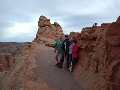
After a week in Capitol Reef National Park, we headed east to Moab. We keep returning so I guess you could say we like it here. There are lots of places to hike here with Arches and Canyonlands National Parks right next door. Cathie and I hiked up Negro Bill Canyon to Morning Glory Natural Bridge. The trail follows a beautiful clear stream and is a popular hike here. Yesterday we hiked down Courthouse Wash, a 5.5 mile hike from Arches down to the Colorado River. Gary and Diane dropped us off at the start and we hiked down a beautiful canyon filled with Cottonwood Trees and a sometimes stream. Towards the end we came to deep water around some beaver ponds. We had to cross the stream to continue and for a while thought we might have to swim. After looking for a place to cross without getting wet, we finally managed to cross by walking across the beaver dam. Later in the evening we all hiked to Delicate Arch, a trek we make every time we come here.

Gary and I spent one morning and hiked to Corona Arch, a very large and impressive arch in an area outside of the National Park.

AN UPDATE:

After 6 weeks, Gary has started to relax and has been seen omitting extra security devices on his Jeep, even in downtown Moab!

Tomorrow we head south to Bluff, Utah, just north of the Arizona Border. The plan is to spend more time hiking, this time to some cliff dwellings which are plentiful in the area.


CORONA ARCH WITH BOWTIE ARCH ON LEFT

EARLY AMERICAN GRAFFITI


CATHIE IN COURTHOUSE WASH

HAPPY HIKERS


Thursday, October 08, 2009

SLOTS, SLOTS, AND MORE SLOTS

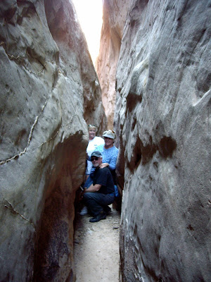
No, no, not the Vegas kind but the canyon kind. One of the natural features of the southwest are slot canyons. Here in southwestern Utah, there are numerous. These vary in length, depth, and beauty, but they are all interesting. Some are difficult to gain access to requiring repelling and climbing gear or require hiking several days to get to, while others you just walk into. The latter are the one’s we’ve been exploring. The three most impressive that we have explored are, Headquarters, Surprise, and Little Wild Horse Canyons. Little Wild Horse was by far the most interesting, being deep, narrow and about 3.5 miles long, with the actual slot being about 1.5 miles long.

Here are some of the photo we took of these canyons.
HEADQUARTERS CANYON
GARY, DIANE, AND CATHIE

THE FOLLOWING PHOTOS ARE OF

LITTLE WILD HORSE CANYON


A LITTLE HELP HERE


DANA AND GARY


Wednesday, October 07, 2009

STOP THIEF!!!!!

Gary, who is traveling with us, owns a 1996 Jeep Cherokee that he tows behind his motor home. Living in Southern California he takes certain precautions to prevent some low life from stealing it. While camping in the Sierras, he continued to take his anti-theft precautions believing that perhaps some of these lowlifes may have followed him north.

He is very concieious about maintaining his anti-theft measures, believing that his ’96 creampuff would be a prize for any would be car thief and would be the envy of his thieving peers.

He has a device which he attaches to his steering wheel with one end and his break pedal with the other. Then he has this bright yellow cover which goes over the steering wheel with a notice on it warning any potential car thieves to stay away. Now in Southern California these measures might be necessary, but I doubt it, because any thief worth his salt wouldn’t be looking the steal a 13 year old Chrysler product.

Here in Utah, Gary remains paranoid. Recently we took a drive on the Burr Trail, a 75 mile dirt road through parts of Grand Staircase Escalante National Monument and Capitol Reef National Park. We stopped for a short hike up a slot canyon, and true to form Gary secured his Jeep. Here we were 48 miles from the nearest paved road out in the middle of nowhere and Gary is still worrying about that lowlife.

I am attempting to get him to relax and have some faint hope that by the end of our 3 month sourjourn he may loose some of his paranoria, because it is doubtful that he will loose his Jeep.

ALL SECURE
NO LOWLIFE THAT WAY


CRIME INFESTED PARKING LOT


Saturday, October 03, 2009

HITCHHIKING GRANDPARENTS! (kids don't try this at home)


SULFUR CREEK

Yesterday, Cathie and I went for a hike down Sulfur Creek in Capitol Reef National Park. To make the hike a one way hike, we left our truck at hikes end and hitched a ride with Gary and Diane to the trailhead. The hike follows Sulfur Creek for 5 miles through a deep red rock canyon and involves crossing the creek numerous times as we head downstream. I was told by a ranger that there was one spot where we would have wade through a deep pool, but otherwise it was to be an easy hike.

So off we went until about halfway down the canyon we came to this deep pool. What the ranger didn’t tell us was that the pool was at the bottom of a 10 foot waterfall, with no way to climb down. You would have to jump or dive down into the deep pool at the bottom of that fall. Not wanting to get “that wet” in freezing water and with the air temperature around 50 degrees we opted to turn around and head back to the trailhead. So 2-1/2 miles down, 2-1/2 back.

Of course, once at the trailhead the truck is parked at the end of the hike so we had another 3 miles of treking down the highway. We tried hitchhiking but I guess we must have looked like dangerous grandparents as no one stopped to pick us up.