Thursday, April 25, 2013

BLUFF...PART TWO


Just across the San Juan River from Bluff is 16 Room House.  Most visitors don't even know it's there.  There used to be a suspension foot bridge across the river leading to the ruin but a flood in 2007 wiped the bridge out.  Now you have to take the long way around by car.  The ruin sits on a ledge in a large alcove.  I climbed up to the ruin, but in order to get inside you would have to grab onto part of the wall to pull yourself up the last part.  I started to do this but I was afraid I would pull the stone out of the wall.  Still pretty fascinating from the outside.

16 ROOM HOUSE

We are staying at Cottonwood RV park here in Bluff.  When we arrived we were greeted by an elderly gentleman who told us to park anywhere and his daughter, who runs the place, would contact us later.  We later met his daughter who told us her family had owned the property for years.  She said she has lived in Bluff most of her life.  Besides the RV park there is a cafe, pawn shop, a store selling Indian jewelry, rugs, pottery and the like.  There are a couple of "motel" rooms in a small duplex plus an old gas station and garage, which are now closed.  She said her mother runs the cafe, so I asked her what time the cafe opened in the morning, thinking we might go to breakfast.  She told me her mom usually opens somewhere around 10 or 11 and then closes around dark.

We paid the cafe a visit because that's where the gift and pawn shop are.  We met the matriarch of the whole shebang who showed Cathie some jewelry she was interested in.  She told us that she had lived all of her eighty years in Bluff and married a local boy.  She and the local boy split their ways sometime ago as he was "like a bee going from flower to flower pollinating each one".  He stays on the property in his trailer from time to time, until he wants to find "more flowers".

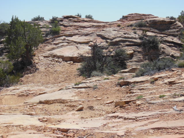
For our last exploration in the Bluff area we headed out in the morning for Cedar Mesa, about 40 miles away.  I had read about an intact Anasazi Kiva that could be reached after 5 mile hike down Bullet Canyon.  We arrived at the trialhead around 9 am and climbed our way down into the canyon.  Heading down canyon was pretty straight forward, but there were several fun spots to negotiate.


 CATHIE HEADING DOWN DRY WATERFALL
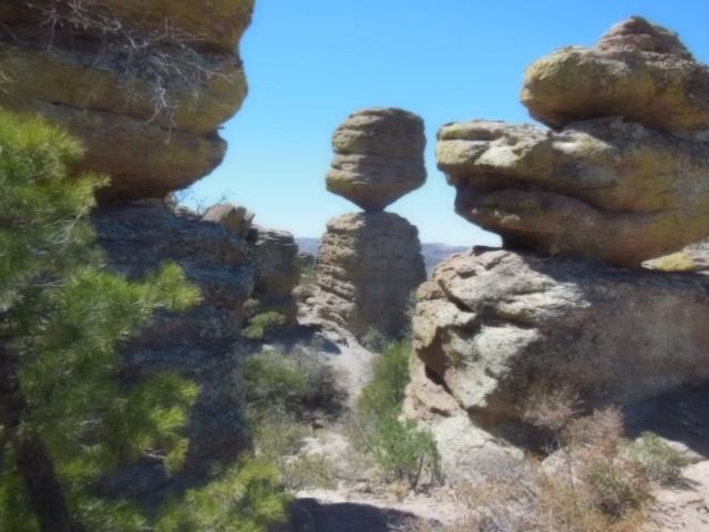
 MY FAVORITE, LEDGES

LOOKING BACK AT A POUR OVER

Before heading down or over each of these obstacles, we had to determine whether or not we would be able to get back up.  Looked doable, so we keep on heading down canyon.

LOTS OF WATER IN THE CANYON

TWISTY TREE

After almost 3 hours and 5 miles, we spied the ruin in an alcove above the canyon floor and picked our way up.

 RUIN WALL CENTER RIGHT

 WE MADE IT


The kiva and the small building are fully intact.  The ladder into the kiva is a modern addition.  The building (room) even has it' roof structure with earth covering.

 INSIDE THE KIVA


NOTICE THE BLACKENED CEILINGS

SOME OF WHAT WE FOUND


CORN COBS


A REAL BLUE BIRD

We spent about an hour at the ruin before heading back out of the canyon.  After ten miles we were really dogging it up on over the obstacles that seemed so easy on the way down.  Oh, I almost forgot, the kiva has a name, it's called Perfect Kiva and I could see why.

From here we're continuing north with a stop at Canyonlands National Park for a couple of days.  Then on to Moab.

Tuesday, April 23, 2013

HEADING NORTH, SLOWLY

It turned out the weather man was wrong about the temperature in Springerville, the low didn't get down to 15 degrees.  I got down to 14 degrees!!  Used 7 gallons of propane during the night to keep warm.  After thawing out, we continued north on Hwy 191 with the next stop being Canyon de Chellly.  We stayed in a really nice campground run by the Navajo Nation for $10.  We arrived early enough in the day to take a hike into the canyon to the White House Ruin.  This is the only place in the canyon that you can enter without a Navajo Guide.  The trail twists it's way 600 feet down from the rim to the canyon bottom.

 THE TRAIL DOWN

WHITE HOUSE

The ruin is protect by a fence so you can't get too close.  There are Navajos who are selling their jewelry, blanket and pottery nearby.  I talked a young woman who was selling her jewelry told me that her family had lived in the area for many years.  She said they still farm in the canyon, planting corn, beans and squash.  They also have peach trees, which she said probably won't produce this year.  She told me the weather has been really cold and after the trees bloomed, they had a freeze.  A couple of days prior to our visit, it was snowing in the canyon.

The next morning we continued northward to Bluff, Utah.  If you are a follower of the blog, you know we've been here before, so I suppose you could say we like it here.  A very small community of about 250 people located on the San Juan River in red rock county.  If you haven't figured it out yet, I like to explore Anasazi Ruins and the area around Bluff is the place to do it.  There are literally hundreds of Anasazi sites in the area that surround Bluff.  We have explored many ruins on previous trips so we visited  new ones this trip.  We first hiked to Hotel Rock, about 7 miles round trip up a very treacherous jeep trial.  It was had to believe that people would drive up this trail.


 THE ROAD

CATHIE WALKING THE ROAD

Hotel rock sits by it's self on a mesa covered with Cedar trees.  It gets it's name from several small ruins that encircle the rock near the bottom.  The rock it self conjures up one's imagination in describing what it looks like.  I think it's a turtle with a lizzard on it's back.

 HOTEL ROCK

 HOTEL ROOMS

CATHIES ARCH

One morning I took a walk up a canyon just outside of town.  It's surprising what you see if you look hard enough.  While walking up the canyon I spied two ruins high on the cliffs.  Too high and exposed for me to reach them, I continued up the canyon for a couple of miles all the time scanning the cliffs for ruins.  On the way back down the canyon, I saw two more ruins that I had walked passed on the way up.  They are so well camouflaged, they blend right in to the cliffs on which they are built.  If very hard for me to imagine someone even building something on the side of these cliffs, let alone getting up there.

Some of what I saw on my walk:


CAN YOU FIND THE RUIN?

HERE'S A CLOSE UP


 The petroglyphs on the rock face are about 300 feet off the canyon floor and another 300 feet from the cliff top.  I could barely see them, in fact I only noticed the figure on the left.  The petroglyph on the right I only saw when I looked at my photographs.  Who in their right mind would cling to the side of the cliff to do this?

LOTS OF POTTERY SHARDS


All of this a more was in sight of the town of Bluff.  I walked for about 3 hours covering around 4 miles.  This is great county.  I was talking to the owner of a restaurant in town who has lived in Bluff most of his life.  He told me that there is no place in the States like Southern Utah where there is so much to explore and see.  I couldn't agree more.

More on Bluff in the next post.

Thursday, April 18, 2013

HERE WE GO AGAIN!

We're off again in the RV, this time for 6 to 8 weeks or until  the money runs out.  We left this past Saturday and headed to Southeastern Arizona to meet up with my sisters, Kathy and Jude.  They wanted to explore the Chiricahua National Monument so we agreed to met them there for a small family reunion.  The monument is about 40 miles south of Wilcox, AZ.  Wilcox is in the middle of no where, so that makes Chiricahua NM south of no where.  There is a small campground that limits the size of RVs to 29 feet, but we figured that at 30 feet we could manage to squeeze in.  We were lucky that Kathy and Jude held the largest campsite for us or else we would have been looking for a different place to stay.  Being south of no where, that would have been a challenge.  Really small campsites and tight turns within the campground.

The monument is known for it's towering rock formations and great hiking opportunities.  To make some of the longer hikes a little shorter and easier, the park service offers a shuttle service to the upper reaches of the monument allowing one to hike mostly downhill returning to the visitor center.  This is the option we chose hiking from just shy of 7,000 feet down to around 5,000 feet.  The 7 mile hike from the top twisted and turned though some pretty amazing rock formations including the highlite of the trail, the "Heart of Rocks".

I messed up with the settings on my camera and all the photos I took turned out fuzzy, but here are a couple shots to give you an idea of the area.


 KATHY ON THE LEFT, CATHIE ON THE RIGHT


After backing partway out of the campground, we parted company with Kathy and Jude after 4 days and headed north.  The plan, which could change for any reason, is to travel US Hiway 191 all the way to Montana.  That means we'll be going through, Eastern Arizona, Eastern Utah, Western Wyoming and Montana.  We haven't figured out our route when we decide to head back towards home, but we'll think of something.

We are currently in Springerville, Arizona where the forecast calls for a low of 15 degrees tonight.  If we survive, tomorrow we will continue north with the next stop, Canyon de Chelly, where I try to get the camera settings right.