It turned out the weather man was wrong about the temperature in Springerville, the low didn't get down to 15 degrees. I got down to 14 degrees!! Used 7 gallons of propane during the night to keep warm. After thawing out, we continued north on Hwy 191 with the next stop being Canyon de Chellly. We stayed in a really nice campground run by the Navajo Nation for $10. We arrived early enough in the day to take a hike into the canyon to the White House Ruin. This is the only place in the canyon that you can enter without a Navajo Guide. The trail twists it's way 600 feet down from the rim to the canyon bottom.

THE TRAIL DOWN

WHITE HOUSE
The ruin is protect by a fence so you can't get too close. There are Navajos who are selling their jewelry, blanket and pottery nearby. I talked a young woman who was selling her jewelry told me that her family had lived in the area for many years. She said they still farm in the canyon, planting corn, beans and squash. They also have peach trees, which she said probably won't produce this year. She told me the weather has been really cold and after the trees bloomed, they had a freeze. A couple of days prior to our visit, it was snowing in the canyon.
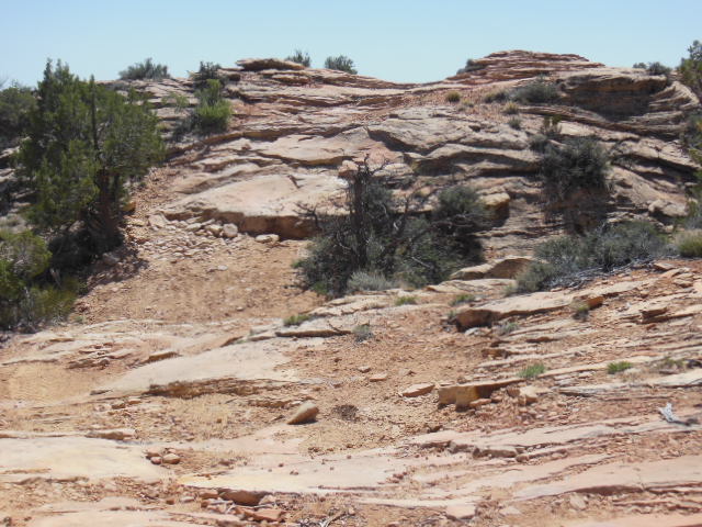
The next morning we continued northward to Bluff, Utah. If you are a follower of the blog, you know we've been here before, so I suppose you could say we like it here. A very small community of about 250 people located on the San Juan River in red rock county. If you haven't figured it out yet, I like to explore Anasazi Ruins and the area around Bluff is the place to do it. There are literally hundreds of Anasazi sites in the area that surround Bluff. We have explored many ruins on previous trips so we visited new ones this trip. We first hiked to Hotel Rock, about 7 miles round trip up a very treacherous jeep trial. It was had to believe that people would drive up this trail.
THE ROAD

CATHIE WALKING THE ROAD
Hotel rock sits by it's self on a mesa covered with Cedar trees. It gets it's name from several small ruins that encircle the rock near the bottom. The rock it self conjures up one's imagination in describing what it looks like. I think it's a turtle with a lizzard on it's back.


 The petroglyphs on the rock face are about 300 feet off the canyon floor and another 300 feet from the cliff top. I could barely see them, in fact I only noticed the figure on the left. The petroglyph on the right I only saw when I looked at my photographs. Who in their right mind would cling to the side of the cliff to do this?


All of this a more was in sight of the town of Bluff. I walked for about 3 hours covering around 4 miles. This is great county. I was talking to the owner of a restaurant in town who has lived in Bluff most of his life. He told me that there is no place in the States like Southern Utah where there is so much to explore and see. I couldn't agree more.
More on Bluff in the next post.

HOTEL ROCK

HOTEL ROOMS

CATHIES ARCH
One morning I took a walk up a canyon just outside of town. It's surprising what you see if you look hard enough. While walking up the canyon I spied two ruins high on the cliffs. Too high and exposed for me to reach them, I continued up the canyon for a couple of miles all the time scanning the cliffs for ruins. On the way back down the canyon, I saw two more ruins that I had walked passed on the way up. They are so well camouflaged, they blend right in to the cliffs on which they are built. If very hard for me to imagine someone even building something on the side of these cliffs, let alone getting up there.
Some of what I saw on my walk:


CAN YOU FIND THE RUIN?

HERE'S A CLOSE UP


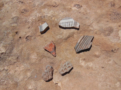
LOTS OF POTTERY SHARDS


All of this a more was in sight of the town of Bluff. I walked for about 3 hours covering around 4 miles. This is great county. I was talking to the owner of a restaurant in town who has lived in Bluff most of his life. He told me that there is no place in the States like Southern Utah where there is so much to explore and see. I couldn't agree more.
More on Bluff in the next post.
1 comment:
Dana and Cathie,
special places and nature of friendship.
Please: the next time we would be there together again.
Post a Comment