It's been about 20 years since I climbed up Whale Peak out in the Borrego Desert and I figured it was about time to do it again. My friend Gary, who has been hankering to go on a hike, said he would go with me. So a couple of weeks ago, I picked him up at 0 dark thirty and we drove out to the desert. The best way to climb this mountain is to drive via a 4 wheel drive road to the 4000 foot level before starting out on foot. The road to the trail head isn't too bad except for one particular spot where high clearance is definitely required. The old 4-Runner handled it well, cutting off about 2 additional miles of hiking if we hadden't gotten over the rough spot.
The first part of the hike is pretty straight forward and pretty much straight up. Well not exactly, but none the less uphill via a slot with lots of boulders.
LOOKING DOWN THE SLOT
Twenty years ago the route to the summit was cross country with one doing their own navigation. Back then I along with friends failed on our first attempt, having taken the wrong turn. The second attempt was successful, but it too required some route finding skills. Anyway off we went on the route I remembered, or at least though I remembered.
GARY COMING UP BEHIND
Everything was going along just fine, when I heard Gary make an odd noise behind me. When I turned to look I found Gary rolling down the hill though some of the ever present Cholla Cactus. Gary's head stopped him from rolling down too far when it met with a non movable rock.
After figuring out that Gary was ok with no broken bones, he said that he had enough of my route finding skills, so after just 3/4 of a mile we turned around and headed back. (Actually Gary was kinda bruised up) We didn't know it at the time, but we were a little bit off track.
Twenty years is a long time, but I thought I knew where we were going. If you take a look at the Google Earth map, the little white dots are the route we selected. The purple line is the route we should have taken, but I didn't enter the correct route in the GPS until after I got home. Duh!
Anyway the mountain was still there and I still wanted to Climb it. So this time I enlisted Cathie, who said she was game to give it a go. She had climbed it with me on the previous summit and figured I could find the way again, especially now that I had the route in the GPS.
It was cold and clear on the way up with patches of snow in the shaded areas. No wind to speak of, so it was a pleasant hike. We got a little off track by trying to avoid some steep sections by side hilling. When we got to the top of one ridge, we looked down the other side and noticed a really nice looking trail crossing the high valley below us. Now 20 years ago, we never came across any trail nor had we heard that there was one. But now 20 years later there it was. So we headed down to the trail and followed it all the way to the summit. With just one steep section just below the summit, the rest of the hike to the top was pretty easy.
CATHIE LOOKING BACK
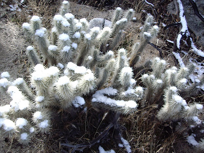
SNOW ON THE CHOLLA
WOW! A TRAIL
SUMMIT REGISTER
SHELTER
THAT'S BORREGO SPRINGS OUT THERE
ON THE WAY DOWN WITH THE TRAIL BELOW
SHELTER
THAT'S BORREGO SPRINGS OUT THERE
ON THE WAY DOWN WITH THE TRAIL BELOW
After about 45 minutes on the summit, we headed back down. This time we followed the trail which made it a piece of cake finding ouR way. Next time we'll follow the trail from the get go. Think Gary will try again? Only if he gets to lead.
WHALE PEAK


