Friday, November 30, 2012

A WALK ACROSS CALIFORNIA

I've always admired those folks who walk great distances.  You've heard about some of them I'm sure, like the guy who walked across the US to raise money for wounded veterans.  There have been others of course, walking for various causes or just for the challenge.  Each year a whole bunch of people hike from the Mexican Border near Campo, California along the Pacific Crest Trail  (PCT) all the way to the Canadian Border in Washington State.  That's 2,600 miles and those are hard miles over numerous mountain passes and across a pretty good section of the Mohave Desert.  Those who hike the PCT carry a full pack, camp out along the way and stop every 6 or 7 days to resupply.  I recently read a blog by a woman who completed the PCT with her 8 year old daughter.  Here's a link:  http://www.sierrapct.blogspot.com/

I recently learned of a pilgrimage route across Northern Spain called the Camino de Santiago.  The length varies depending one where one starts, but the Camino ends in Santiago, Spain.  The origins of the Camino de Santiago goes back one thousand years and it was an important christian pilgrimage route during the middle ages, all walking to seek forgiveness from St James. It is thought that the remains of the Apostle Saint James is buried in the Cathedral of Santiago de Compostela.  In modern times pilgrims walk it for many reasons, not only religious, and to be a pilgrim has changed its meaning. What attracts people to the Camino de Santiago today, it is the mix of adventure, seeing Spain and its culture and the camaraderie that builds up over several weeks of walking. Pilgrims that walk come from all over the world and that creates a great environment. Mix that with some good Spanish wine and food, and you have the perfect experience.


The most popular route, Camino Frances, starts in Saint Jean de Pied de Port, France, crosses the Pyrenees into Spain and stretches over 500 miles to Santiago.

I would love to walk the Camino Frances, but it's just not in the cards at this time.  I'll put it on my bucket list and hope I'll be able to do it in the future.

But it got me thinking.  I've been sitting around doing nothing lately, spending way too much time on this computer, and putting on a few pounds.  I felt the need to get up off my ass and challenge myself by doing something that required me to be active and get a few pounds off.  So I thought, why not walk to Yuma?  Keep in mind that I said walk, not backpack.  So, I enlisted the help of my beautiful wife who will be my support team on my trek.   I've picked a route that will keep me off the freeways and on secondary roads for the most part.  I will start from home and walk till I feel the need to stop.  Then I will summon Cathie with my trusty cell phone, who if she can tear herself away from what ever she's doing and come and pick me up, taking me home for the night.  Then the next morning she will return me to the spot she pick me up the day before and I will continue walking.  Sounds like a plan.

I'M OFF THEN
DAY ONE
11/27
15.1 miles

Starting just before 7 am, I walked till about 9 before the sun came out from behind the clouds.  Walking along busy roads is not really pleasant with the noise plus walking on the hard surface hurts the sore foot.  (more about that later) As I walked through Spring Valley, I recalled the time I used to patrol the same streets I was now walking on.  The neighborhoods have changed some and not for the better.  More run down, trash in yards, broken down cars on what was once the front lawn.  Luckily, the vast majority of my walk will not be walking through neighborhoods.


HEADING UNDER HWY 125 

LOOKS LIKE LA PRESA (SPRING VALLEY) 

AHH, THAT'S BETTER

Leaving Spring Valley behind I continued heading east along Jamacha Road stopping at the local Carls Jr. to use the facilities.  I've been trying to stay completely off the road surface, but there are times when it unavoidable.  Took a short break in the parking lot of Cottonwood Golf Course, eating a quick lunch.  After 4.5 hours of pretty much continuous walking I gave Cathie a call telling her to start heading my way.  I continued walking figuring to get a few more miles in before she arrived.  When she did get there, I had walked for 5 hours 45 minutes and covered 15 miles.   Not too bad for the first day.

DAY TWO
11/28
13.3 Miles


Around 5:30 as I lay in bed it crossed my mind that I really don't have to get up.  So I watched the clock click off 5 more minutes and thought to myself, what am I thinking, I've got to get to Yuma!  So Cathie dropped me off where I left of yesterday and headed east.  Traffic is heavy for a country road due to the Indian casino up ahead.  Once past it the traffic becomes non-existence.

There are some spots along the road that there is little room for a pedestrian.  With light traffic I can hear cars coming and get out of the way.


I'M BEING WATCHED

Most of today's walk was uphill and much of the time I had to walk on the road surface.  This aggravated my sore foot making walking painful at times.  I would get relief when I was able to walk on dirt instead of asphalt.  About the foot.  I have Morton's Neuroma in my left foot.  I've had it for the past several months, and at first it was very painful but it's gradually getting better.  Of course walking to Yuma isni't going to help.  I'll take a day off now in then if it gets too bad.  Walked for the same amount of time as yesterday, but at a slower pace due to the steady climb.  Forecast says rain for tomorrow, so I'll have to wait and see.

DAY THREE

11/29
12.8 miles


It's drizzling this morning so I started out in a light rain jacket (Marmot).  I don't know if it kept the rain out or not because I was sweating with the uphill climb and I got pretty wet from the inside out.  Mostly up hill today starting at 2200 feet and finishing at 4000 feet.  After 7 miles I finally reached Interstate 8.  From here on out I'll be walking on Old Hwy 80.  For the most part the shoulder is wide much of the time so it means I can walk facing traffic.  Until now I've been walk on what ever side of the road is wider.  Only walked for 5 hours today as my foot is bothering me.  Made it as far as Guatay.


SOME OF THE FOLKS I MET TODAY


DESCANSO VALLEY

Thursday, September 27, 2012

TELESCOPE PEAK AND KEARSARGE PASS


It’s been hot in San Diego for a while now, so I figured I needed to go somewhere where the weather is different. I chose Death Valley. Well actually I chose a mountain in Death Valley National Park. At just over 11,000 feet, Telescope Peak in the Panamint Range just west of Bad Water. The peak is the highest mountain in the park and in the Panamint Range from it you can see the lowest point in the United States. And I might add, at 11,000 feet, it’s cooler than Bad Water and San Diego.

I had been considering this hike for some time now and figured I better do it now, as later in the year, snow becomes an issue. Also it was my birthday and as a present to myself I wanted to do this hike. Friend Mike was going to tag along, but had to cancel at the last minute due to a family emergency. Since the trip was planned, I decided to go it alone.

Getting to the trailhead requires a six hour drive to Death Valley National Park.  You drive up Wildrose Canyon passing the Wildrose Canyon Charcoal Kilns.  Built in 1877 by the Modock Consolidated Mining Company, they provided charcoal for the mine smelter.  The last 1.5 miles to Mahogany Flats Campground and the trailhead required 4 wheel drive as the dirt road was severely damaged in recent thunderstorms.  At just over 8,000 feet, I spent the night in order to acclimate to the altitude. After I arrived and set up camp, another couple arrived who had the same intent as me. I felt a little better known someone else would be on the trail.


CHARCOAL KILNS IN WILDROSE CANYON


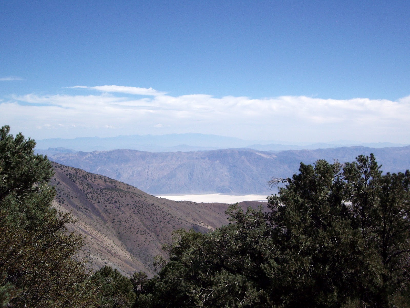
        DEATH VALLEY VIEW

The wind really blew most of the night, but I slept well in spite of the tent rattling. I got up early, had breakfast and started up the trail at 6:30. As a testament to the wind, the sign pointing the way had blown down during the night.  As I climbed I watched the sunrise over Death Valley, my photo of which turned out blurry so it's not here. Because of the wind, the views were hazy and full of dust, which was a disappointment. The first 2 miles of the hike are continuously up hill and because the trail traverses the eastern slope of the mountains I was protected from the wind. After 2 miles the trail levels out, with view to both the east and west. No longer protected from the wind I started getting cold. Although the air temperature was probably in the high 40's the wind chill had to be near freezing.  My hands got so cold that I needed to put on my heavy winter gloves. I’m glad I came prepared.  With the wind like it was, I was a little concerned about how bad it would be on the summit.


STEADY UPHILL

FIRST VIEW OF THE SUMMIT

Once reaching this first saddle, the trail levels out and traverses Arcane Meadows, skirting round the western slope of Bennett Peak. The trail stays level for about 2 miles before starting it’s final ascent to Telescope Peak. The old route followed the ridge up to the summit, but the new trail stays on the eastern side of the mountain, climbing up 13 switchbacks. (Yes I counted them). This kept me out of the wind and the climb was less steep. I didn’t say it wasn’t steep, just less steep. As I topped the ridge I could see the summit about ¼ mile away. The wind stopped for my birthday and it was quite pleasant following the ridge to the summit.

ARCANE MEADOWS

SUMMIT IN THE DISTANCE

GETTING CLOSER

JUST ONE MORE MILE

SUMMIT IN SIGHT!

Although there was no wind for my 30 minute stay on the top, the views were marred by the haze. I had taken me 4 hours to make the climb. The official mileage is 7 miles, but my GPS showed it at 6.2 miles. I have read other accounts of the climb, and 6.2 or there abouts was reported. I had the summit to myself, signed the register and had lunch before heading back down. On the way down I met a couple from Canada on their way up. Never did see the couple who was camping at the trailhead. I guess they chickened out.

HAZY VIEW OF DEATH VALLEY

JUST TO PROVE I WAS THERE

I made it back to the car at about 2:00 and after a sandwich, I headed to Lone Pine for a shower at the Mt. Whitney Hostel. For $5 you get a towel, soap and can stand under the hot water for as long as you like. After getting cleaned up, I drove to Independence and found a place to camp at Gray’s Meadow beside Independence Creek. After dinner it was off to bed by 9:00.


Up early the next morning, because when you go to bed at 9, you’re wide awake by 5 and also I had another hike planned. After breakfast, I drove to the trailhead at Onion Valley just up the road from where I camped. Cathie and I had hiked here last year, but due to a heavy snow pack we didn’t get far. The plan was to climb to Kearsarge Pass at 11,760 feet affording spectacular views into Kings Canyon National Park. According to the written description in a book I have, it indicated that it was an 11 mile round trip, with and elevation gain of just over 2600 feet. Turns out the written description is wrong again as my GPS showed the round trip mileage at 9.5 miles. The climb to the pass was steady so it wasn’t too steep. Higher than Telescope by about 700 feet, it was an easier hike. The views on the way up were only topped by the view into Kings Canyon Park.

SIERRA SUNRISE

HEART LAKE ON THE WAY UP

THE PASS IS IN VIEW
LEFT SIDE OF PHOTO
JUST TO THE RIGHT OF THE BUMP

This is a popular trail and although not crowded, you do run into people. On the way up I could look back and I kept seeing this one person. You could tell he was moving fast and every time I saw him he was getting closer. I figured it must have been some young stud by the speed he was traveling. Finally when he caught up with me, he was just another old guy my age. We exchanged greetings as he passed and I thought that if I could get right behind him, his slipstream would help me up the hill. Such was not the case as I couldn’t go fast enough to get that close behind him. He reached the pass about ½ mile ahead of me.


FAST HIKER (JIM) WENT WHIZZING BY

When I did reach the pass, introductions were made and I learned that Jim, the same age as me, was from West Virginia and since retiring about 5 years ago makes a two week trip to the west every year for the sole purpose of hiking. He said besides Zion, the Eastern Sierras is his favorite place to hike. He told me of the places he had hiked on this trip and many were places I too had hiked.

ALMOST THERE


THE PROOF I WAS THERE SHOT

INCREDIBLE VIEWS

OVERLOOKING BIG POTHOLE LAKE

HEADING DOWN AND LOOKING
BACK AT THE PASS

INDEPENDENCE BELOW


After spending about 45 minutes enjoying the views at the pass, along with 4 other hikers, I started back down. Jim had left before me, but as it turned out, I was much faster going down hill than going up and in short order I caught up with him. We hiked together to the trailhead telling stories of the places we had been. Nice company for a couple of hours.

Unfortunately that was all I had time for, so after another good nights sleep I headed home.  Of course I had to stop for breakfast at the Alabama Hills Cafe in Lone Pine, a reward for  my efforts.

Tuesday, September 04, 2012

SUMMERTIME

Sometimes I think we've been spending too much time at home.  I feel like we haven't be going anywhere or doing anything, which for me means, I want to get on the road.  Well, we're not hitting the road anytime soon, at least nothing is planned.  When I think about it, we really haven't been sitting around doing nothing.  It just feels like it with the hot weather we've been having the past month or two.

So far this year we've actually been pretty busy and on the go.  Let's see, we started out by taking off to Belize for 10 days.  We had a great time with friends Gary and Diane, snorkeling, cave tubing, and of course eating way too much.

 BELIZE SUNRISE

Shortly after returning home, I participated in the National Offshore One Design (NOOD) sailing race.  Due to the high winds and rough seas, the offshore part became in the bay, but still an exciting time.


In May our friends Hansjorg and Silke paid us a visit from Germany.  We met up with them in Utah and spent a week checking out the southern part of the state.


Then in June we took off for the Eastern Sierras for 10 days of hiking.  We got a lot of exercise and were beat on the last hike we took.  Great scenery though.


Next up was a week at Santee Lakes with family.  All ten of the grandchildren were there causing Grampa to head home several nights to recover.


In the past month we've spent about 10 days sailing on our boat, Nice Aft.  We've invited friends to sail with us, regulars Duane and Sherri and new commers, Joe and Terry.  The weather has been great for spending time on the water. (read hot and humid).  This past Labor Day weekend was the Festival of Sail in San Diego bay, so we took the opportunity to get up close to some of the tall ships.  At the end of each days sail we participated in Happyhour on board.


So why is it that I think we haven't been doing anything?  My way of getting over this feeling, besides actually going somewhere, is to start planning for the next big trip.  That would be Europe in 2013.

We're narrowing down the starting point to sometime around the middle of September and have a rough idea of where we want to go.  First up will be 5 or 6 days in London, before heading out for about 4 weeks to explore England, Wales and Scotland.  I've been surfing the Internet looking for B and B's to get some idea of costs and where we might want to stay.  Then we will return to London and take the EuroStar to Paris where we will meet up with Hansjorg and Silke.  We've reserved this apartment for our week in Paris.  You can read all about the apartment HERE.


After Paris, we will travel with Hansjorg and Silke to their home in the Black Forest for a week of German hospitality before returning home via Zurich Switzerland. (Unless of course I can talk Cathie into spending another week in the South of France).

So I guess we have actually been pretty busy, but I still feel the need to get out there and go somewhere.  Guess I better get busy!


Thursday, July 05, 2012

THIS TRIP IS ABOUT HIKING


We continued the theme of this adventure by hiking just about every day.  We took a hike up Horse Creek from Twin Lakes near Bridgeport.  We've hiked here before, but the views are great so we did it one more time.  Horse Creek is one of the few places in California, especially in the Eastern Sierra, were there are beaver. About 3 miles up the trail is a large beaver pond.  I've been there before, but I don't remember a beaver pond, so perhaps they moved in the past couple of years.

TWIN LAKES

TUFA TOWERS AT MONO LAKE


Just outside of Yosemite near Tioga Pass, Mt Warren (12,327 ft) was on my list of a peaks to climb.  The only problem was that I didn't have a good description of what route to take to get to the summit.  I knew where to start and had seen some photos of others who made the summit, so I figured it was a go.  I had my GPS figuring it would help me to the top, but I soon found out that the route I selected didn't seem right.  Long story short, I never made it to the summit.  But I learned two things.  One, the next time I attempt it I believe I've got the route figured out.  The second was that all important information about the bears.

The above photo was taken on my Warren attempt.  The pointy mountain in the distance is Mt Dana which I climbed last year.

After a week hiking around and in Yosemite, we decided to move camp down to Bishop to be closer to some trail heads there.


Wanting to make it to the top of at least one mountain on this trip, we opted to climb Trail Peak.  It doesn't look like much in the photo, but at 11,600 feet, the elevation makes makes it challenging.  The hike starts out easy enough on a trail, but to reach the top, it's off trial for the steepest and last third of the climb.

Last year I made a solo climb up to the summit and figured it was time for Cathie to make it to the top.  It was pretty slow going, but she made it.


Without a cloud in the sky the views were stupendous in all directions.  We ate lunch on the summit and signed the register before heading back down.  Down is definitely easier than up.


The happy hikers on the summit.


CATHIE ENJOYING THE VIEW


We took an easy hike up Little Lakes Valley to Chicken Foot Lake.  This is a  popular hiking trail out of Rock Creek Canyon.  With little elevation change, it invites families to explore.  For us it was a great change of pace, enabling us to take a nice stroll.  We did see a lot of people though.

NATURES RECLINER

THE VIEW AT CHICKEN FOOT LAKE

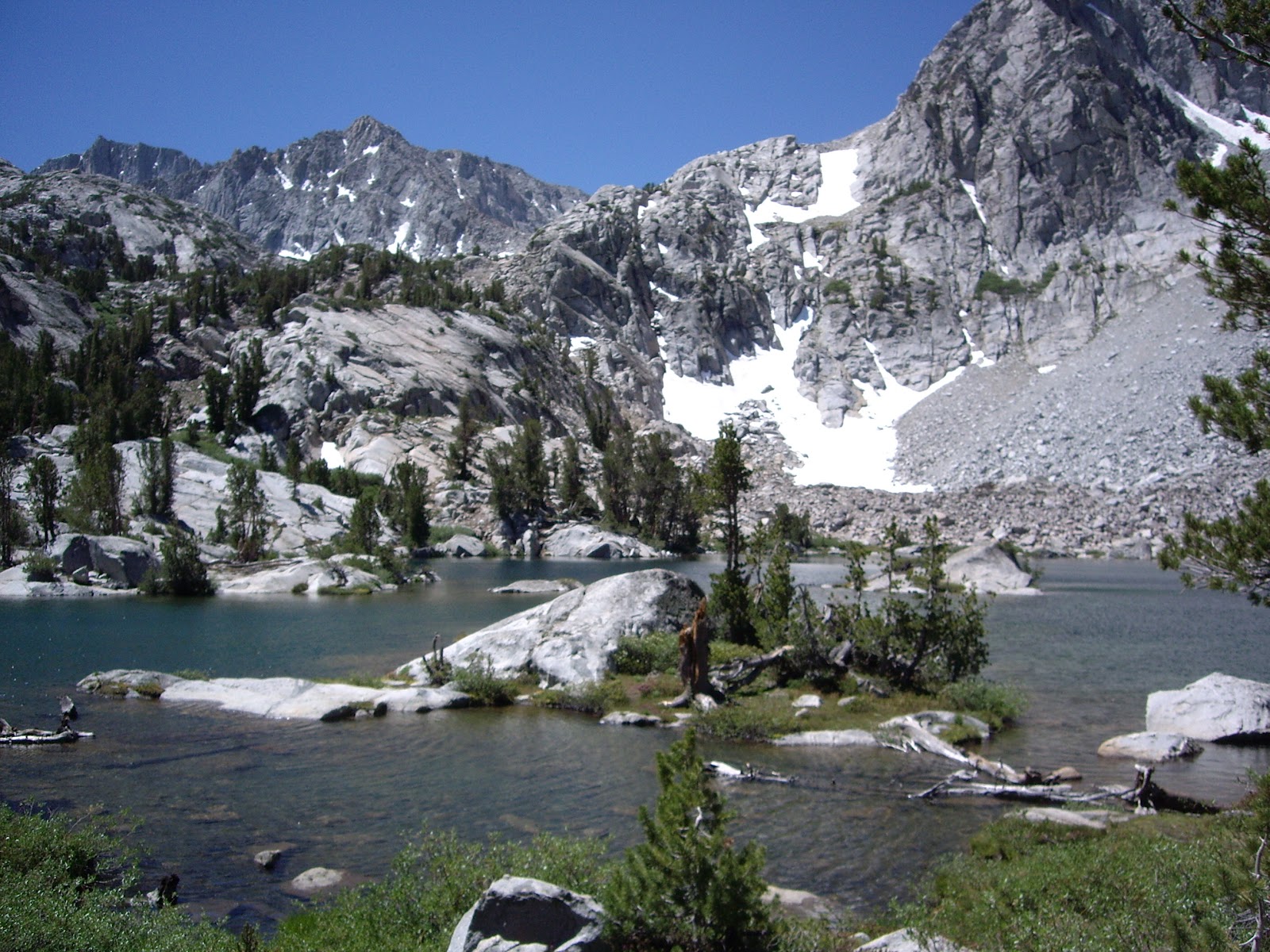
For our last hike we picked another short (6 miles) hike to Treasure Lakes.  Although not considered strenuous, after hiking 10 days out of the past 12, it wasn't long before we knew it was time for a break.  On the way back to the trail head, the up hill sections were really affecting us.  We were pooped so we decided to head home the next day.  We will be back!


ONE OF THE TREASURE LAKES