Sunday, October 13, 2024

FARTHER SOUTH

While still in Illinois, we started feeling the effects of Hurricane Helene with wind in the 40 MPH range and lots of rain.  No flooding where we were, but we did see some of the local creeks swell and spilling over their banks.  It rained pretty solid for 3 days before letting up some.  We managed to stay dry and see what we had intended on seeing.
In Kentucky we stayed in a nice Corp of Engineers campground (COE) in The Land Between The Lakes.  Formed when the Kentucky Dam across the Tennessee River was built.   The resulting lakes surrounded the high ground forming a 170,000 acre inland peninsula.  Approximately 110,000 acres are in Kentucky and 60,000 in Tennessee. Lake Barkley and Lake Tennessee are part of the Tennessee Valley Authority which provides power, flood control in addition to miles of river and lake fishing and boating. In my opinion, COE campgrounds are above the rest in the Federal Park system.  Clean, well maintained and usually scenic.  That campsites are spacious with plenty of space between you and your neighbor.


We took the scenic drive which travels the length of the peninsula taking us to a demonstration village set in the 1800’s. Most scenic drives in the east and south consist of a road or highway cut through the thick forest allowing you views of the trees.  Unlike the west, there are few grand vistas.  At HOMEPLACE the demonstration village, the buildings are original but moved there from other homesites in the area.  Not too many demonstrations going on being a weekday, but volunteers who were there answered all our questions.  Check out some of the building methods of the time.


We next headed to Eastern Tennessee to visit a friend.  The community where he lives was spared from hurricane damage, but many places within a few miles were devastated.  We made one more stop at DEFEATED CREEK, another COE campground. This one was a real gem right on another TVA lake.  We were disappointed that we would only be staying one night.  It gets its name from a Cherokee Indian attack on a group of settlers who were surveying the area and were run off by the Indians.


In getting to Eastern Tennessee, we abandoned the blue highways and jumped on the Interstate.  We noted that driving on blue highways was way better and less stressful.  After a month of avoiding the Interstate and now on one, we knew that blue highways were the way to go. We stayed 3 nights camped in front of Randy and Liz’s beautiful home in the Tennessee hills.  Randy and I used to work together back in the day.  We enjoyed catching up, telling war stories and reminiscing about our old partners.  We barely scratched the surface so perhaps there’ll be another visit in the future.


We took a little time away from the story telling, and attempted to pay a visit to Davy Crockett’s birthday place.  We soon discovered that a visit was not possible due to the flood damage it and the adjoining campground sustained.


Leaving Randy’s we again took the Interstate back to the west, landing in Nashville for a couple of nights for a resupply.  It is here where we will turn left and head to New Orleans.


Sunday, October 06, 2024

SLOW TRAVEL CONTINUES

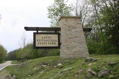
 We continued southeastward still sticking to Blue Highways, passing through many small towns and staying in government campgrounds.  In the small town of  Keosauqua, say that three times fast, we stayed in a beautiful state park of the same name.  The towns population is less than a thousand souls and at lest some of it’s livelihood comes from supporting folks who canoe the Des Moines River  The town derives it’s name from the Meskwaki and Sauk Indians, meaning, bend in the river. Being right on the river an early morning sunrise walk was in store.  Heavily wooded, most of the views were restricted but I did manage to see the sunrise. Still beautiful made all the more enjoyable with numerous deer scurrying away upon my approach.


Continuing on we reached the Mississippi River in the town of Canton Missouri. Here we managed to snag a spot in a city park which is situated on a narrow strip between the river and the railroad.  The best of both worlds, watching river barges entering and exiting the locks and trains going by right behind the RV.  Who could ask for anything more.  Most of the barge tows comprise of 15 barges, three abreast pushed by a powerful tug.  The locks can accommodate the width of the three barges, but the 15 barge length is too long to fit.  The group is split and sent through in two sections, which takes time.  At times they line up waiting for their turn through.


                                                             A MISSISSIPPI RIVER SUNRISE

After a couple of days we moved on crossing the river into Illinois, stopping in Springfield to explore the State Capital.  It is our practice to visit the capital in states we pass through, taking in the capital building and other historic sites.  Being the Land of Lincoln, Illinois and its capital is full of sites relating to President Lincoln.  His home, THE LINCOLN PRESIDENTIAL LIBRARY AND MUSUEM  are within walking distance of each other.  The Library just had a few displays, but the museum was very well done.   His HOME has been restored and much of the furniture inside belonged to him.  Operated by the National Parks, you can take a guided tour which is free as required by Lincoln’s son when he donated the house to the government.  The four square blocks around the house have been purchased by the Park Service and the homes and buildings have been restored.  Many are open for you to explore on your own, with docents available to answer your questions.  We were disappointed that we were unable to tour the capital building as it was undergoing major restoration project.


Heading south we crossed the Ohio River at Paducah, Kentucky.  If we had known about the Brookport Bridge, we would have jumped on the interstate to cross the river, but we didn’t know until it was too late.  So we’re going along fat, dumb and happy when we come to bridge,  It was appropriately painted blue as a blue highway crosses it.  After entering the steep approach to the bridge, Cathie says, “Did you see that sign back there? It says the hight restriction is 9”6’!”  Nah, that can’t be right, must be the width.  We are 11’7” high, but it had to the reference to the width.  The bridge is a steel deck bridge which what wet because of the rain. That made it very slippery, spinning the tires up the steel ramp and a little bit of fishtailing.  That will get your attention when pulling a trailer.  Not fun.  Turns out the height is higher than 9”6’, the sign is meant to keep semi-trucks off the bridge.  It didn’t refer to the width either as the width restriction was 8 feet.  We’re having fun now!  It was a white knuckle E-ticket ride with a high pucker value.  Just shy of a mile in length our hearts were pounding and we breathed a huge sigh of relief having made it.  I would do it again in a car, but never with a trailer.  That’s why it’s called Gassaway’s Adventures.


NOT MY VIDEO

Next up, Kentucky and Tennessee